Сайт использует куки. Cookies необходимы для вашего удобства и веб-статистики. Продолжая использовать сайт, вы соглашаетесь с условиями конфиденциальности куки-файлов! Вы можете ознакомиться с условиями политики конфиденциальности в здесь.
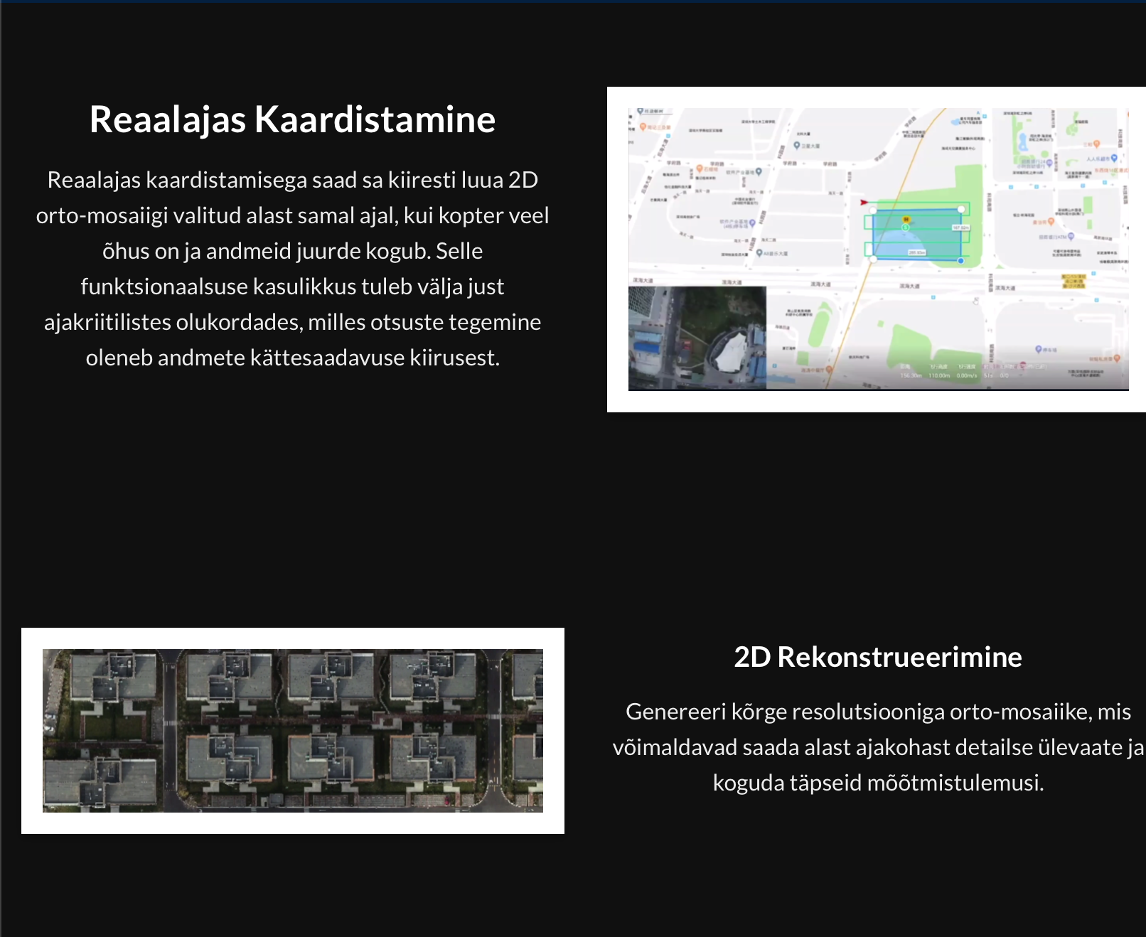
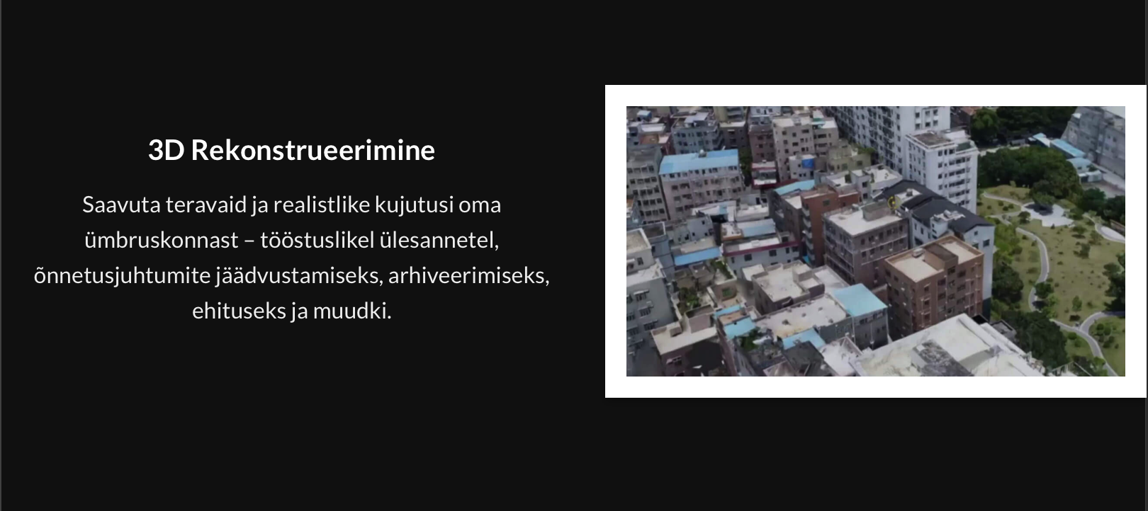
With DJI Terra, it is possible to create 2D or 3D models from the data collected by DJI drones and make easier measurements on them. DJI Terra software is mainly used to quickly create a model from the collected data. We recommend further data processing with, for example, Agisoft Metashape software.
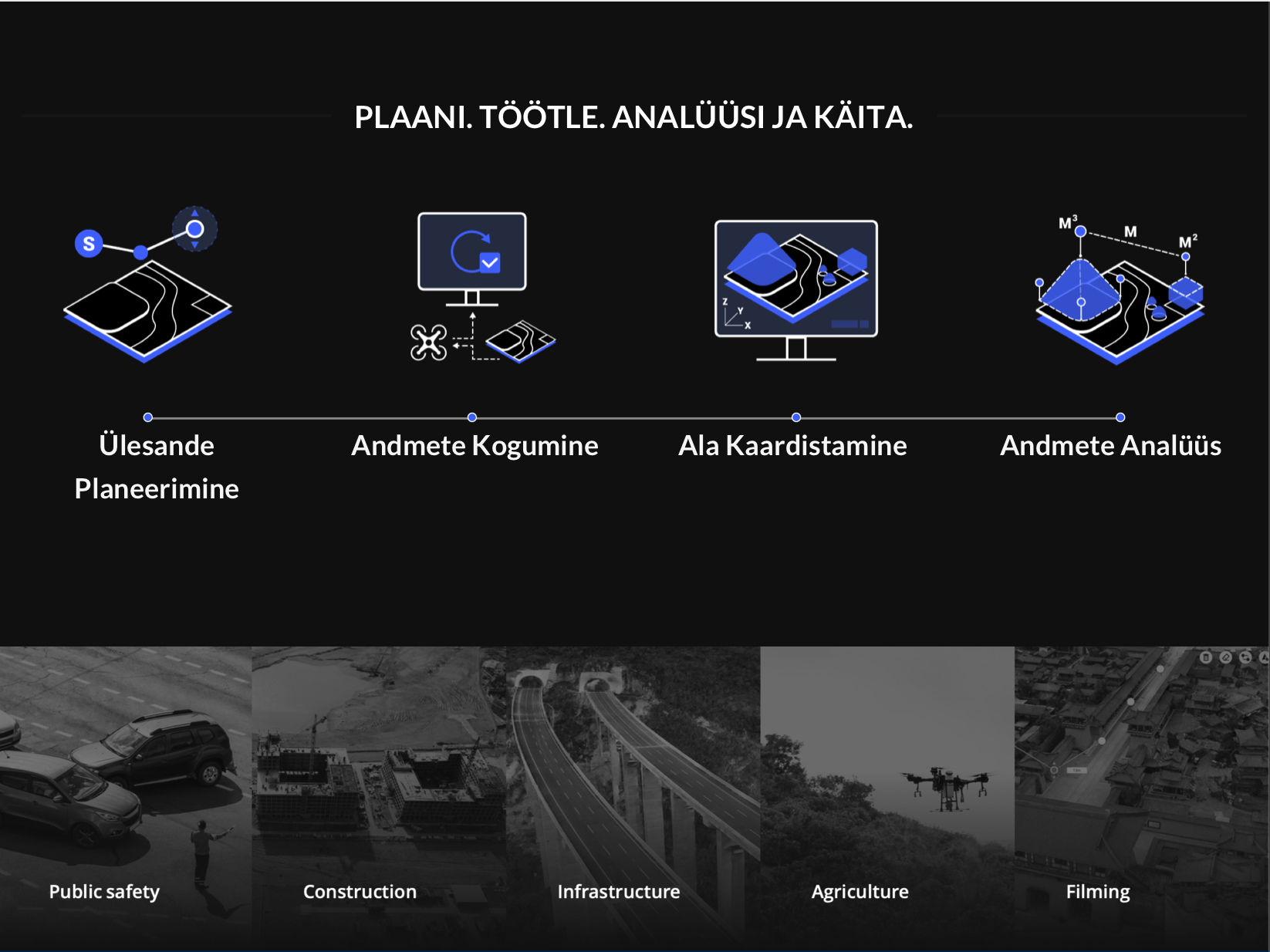
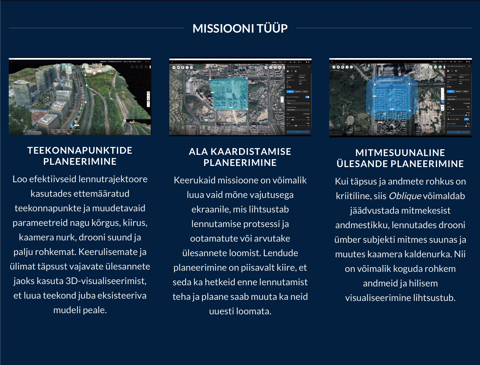
Terra Features:
Creating photogrammetric mesh models from photos — B3DM, PLY, S3MB, OSGB, OBJ, I3S
Creating a point cloud from the data captured by the Zenmuse L1 LiDAR camera — PNTS, PLY, S3MB, LAS, PCD
You can also extract point clouds from photos
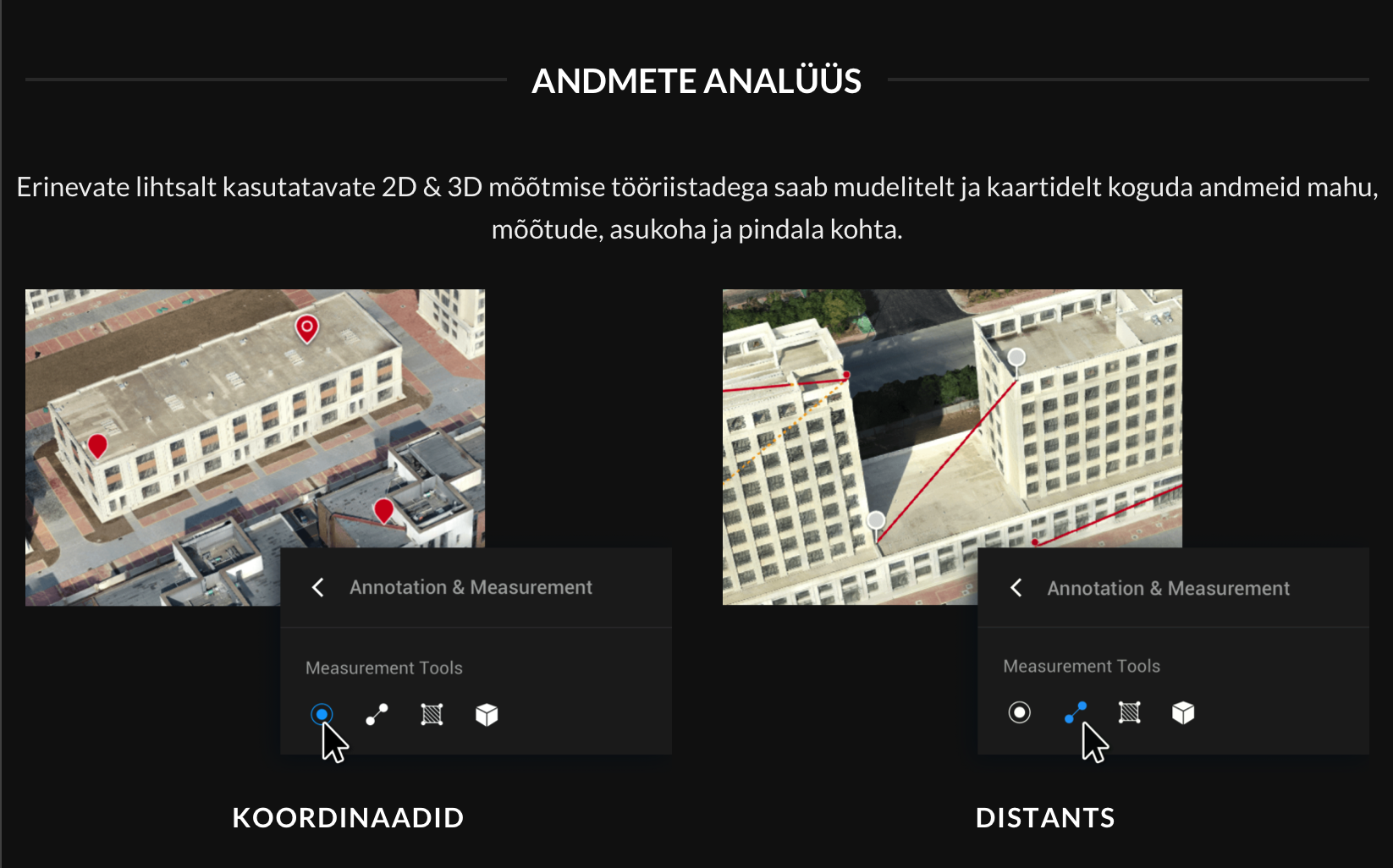
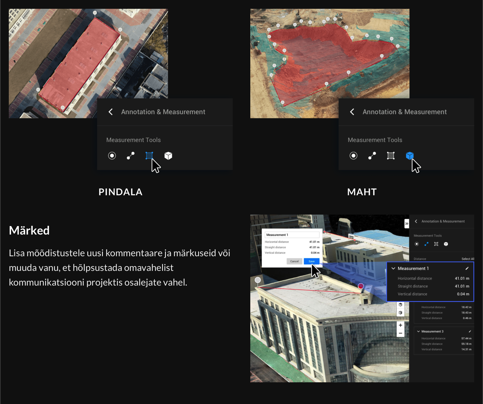
Measurement options: distance, area, volume coordinates