Kauplus: Villardi 22, Tallinn +372 5835 1267


DJI Terra
With DJI Terra, it is possible to create 2D or 3D models from the data collected by DJI drones and make easier measurements on them. DJI Terra software is mainly used to quickly create a model from the collected data. We recommend further data processing with, for example, Agisoft Metashape software.
Terra Features:
Creating photogrammetric mesh models from photos – B3DM, PLY, S3MB, OSGB, OBJ, I3S
Creating a point cloud from the data captured by the Zenmuse L1 LiDAR camera – PNTS, PLY, S3MB, LAS, PCD
You can also extract point clouds from photos
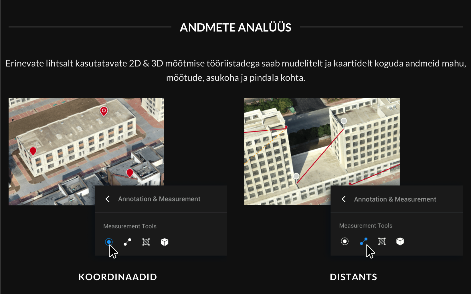
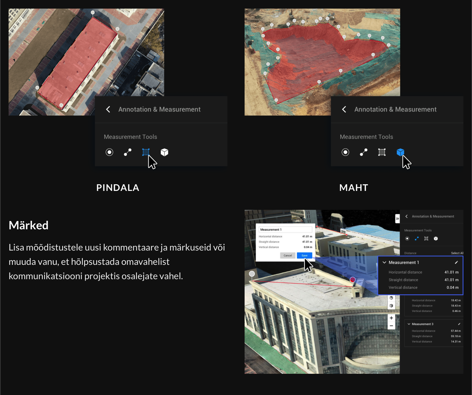
Measurement options: distance, area, volume coordinates
Find out about the free Demo here or write to us at info@droon.gramet.ee.
1,699.00 € – 4,499.00 €
Monthly payment from 31.71 €
Tarne
Tarneviisi saad valida ostukorvis.
-

Pakiautomaati
1-2 tööpäeva
-

Kuller
1-2 tööpäeva
Related products
-

BetaFPV 450mAh 4S 75C Lipo (2pc)
45.00 € -


Mavic Pro Gimbal Clamp
3.00 € -

DJI Care Refresh (Mini 2, 2 years)
79.00 € -


DJI WCH2 laadimisdokk
59.00 € -


Vallerret – Power Stretch Pro Liner with touch
29.90 €